- التسوق ، اصبح سهلا.
- /
- احصل على التطبيق!
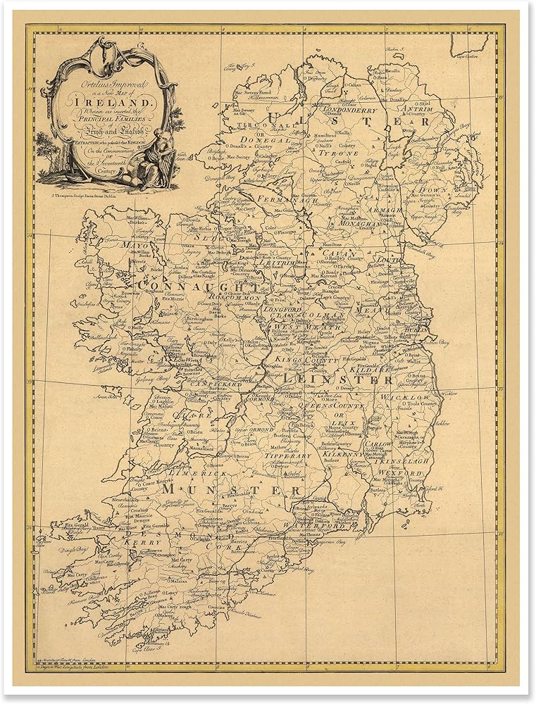
Step back in time with this exquisite vintage map reprint of Ireland, focusing on the historic province of Munster. This beautifully detailed cartographic print showcases the intricate geography, settlements, and territorial divisions of 18th century Ireland. The aged parchment-style background and ornate cartouche create an authentic period aesthetic that would enhance any room's decor. The map features remarkable detail of coastlines, towns, and regional boundaries, with particular attention to the southern regions including Kerry, Cork, and Tipperary. Perfect for history enthusiasts, genealogists, or anyone with Irish heritage, this antique wall art piece serves as both a decorative element and a fascinating historical document. The map's careful reproduction maintains the charm and character of the original, making it an ideal focal point for offices, studies, or living spaces. Each location is clearly labeled in period-appropriate typography, allowing viewers to trace historical places and understand Ireland's geographic evolution.
 خرائط Antiguos الحدود المحيطة بلجوبستون ومتنزه غراند تيتون الوطني حوالي 1929 | ملصق طباعة الفن عتيقة ديكور الجدار | 18 × 24 بوصة (457 × 610 مم)
KWD 9
خرائط Antiguos الحدود المحيطة بلجوبستون ومتنزه غراند تيتون الوطني حوالي 1929 | ملصق طباعة الفن عتيقة ديكور الجدار | 18 × 24 بوصة (457 × 610 مم)
KWD 9
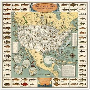 خريطة أسماك كبيرة في أمريكا الشمالية ، دليل صيد مياه طازجة وملحية ، طباعة فن الجدار الزخرفي (24 × 24 بوصة)
KWD 7.500
خريطة أسماك كبيرة في أمريكا الشمالية ، دليل صيد مياه طازجة وملحية ، طباعة فن الجدار الزخرفي (24 × 24 بوصة)
KWD 7.500
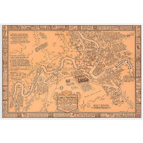 خرائط Antiguos تصوير كبير لفورت واين إنديانا في عام 1812 حوالي عام 1930 | ملصق طباعة الفن عتيقة ديكور جدار | 24 × 36 بوصة (610 × 915 مم)
KWD 11.500
خرائط Antiguos تصوير كبير لفورت واين إنديانا في عام 1812 حوالي عام 1930 | ملصق طباعة الفن عتيقة ديكور جدار | 24 × 36 بوصة (610 × 915 مم)
KWD 11.500