- التسوق ، اصبح سهلا.
- /
- احصل على التطبيق!

Unique, color banded, this political LARGE PRINT map of IOWA state features geographic details. The map shows all county boundaries, county names with their capitals. Perfect for Schools, Home, Office or Home Schooling.
 -5%
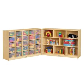
Jonti-Craft 04280JC 25 Cubbie-Tray Mobile Fold-N-Lock Storage مع صناديق واضحة
KWD 603
-5%
Jonti-Craft 04280JC 25 Cubbie-Tray Mobile Fold-N-Lock Storage مع صناديق واضحة
KWD 603
 ورقة قراءة مرشدة من Patikil A4 ، 6pcs تصحيح الإضاءة مرشح جل ملونة فيلم ملون شفاف لاستوديو الصور الفصول الدراسية ، الأصفر
KWD 5
ورقة قراءة مرشدة من Patikil A4 ، 6pcs تصحيح الإضاءة مرشح جل ملونة فيلم ملون شفاف لاستوديو الصور الفصول الدراسية ، الأصفر
KWD 5
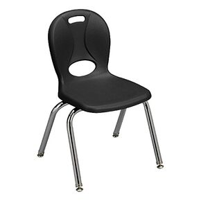 Learniture LNT-114-CSW-So-BK Series Series Series School for Classroom ، 14 "ارتفاع المقعد ، الأسود ، حزمة 4
KWD 122.500
Learniture LNT-114-CSW-So-BK Series Series Series School for Classroom ، 14 "ارتفاع المقعد ، الأسود ، حزمة 4
KWD 122.500
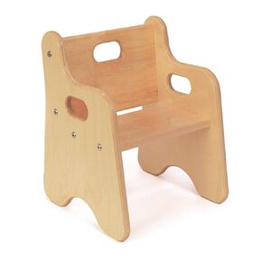 الكرسي الأول حسب البيئات ، ارتفاع مقعد 8 بوصات ، كرسي خشبي متين للحصول على الدعم والراحة للأطفال الصغار ، رائع لمرحلة ما قبل المدرسة ، الفصول الدراسية ، والأدوات النهارية والمنازل
KWD 28
الكرسي الأول حسب البيئات ، ارتفاع مقعد 8 بوصات ، كرسي خشبي متين للحصول على الدعم والراحة للأطفال الصغار ، رائع لمرحلة ما قبل المدرسة ، الفصول الدراسية ، والأدوات النهارية والمنازل
KWD 28