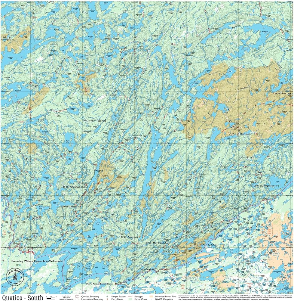
Navigate Quetico Park with Confidence: This detailed cloth map provides topographic coverage of Quetico's lakes, trails, and portages, making it an essential guide for canoeing, hiking, and camping in the park's remote wilderness.
Waterproof and Durable Material: Made from high-quality, tear-resistant cloth, this map is built to withstand the elements, including rain, wind, and rugged terrain, ensuring it remains reliable on every adventure.
Detailed Topographic Features: Clearly marked entry points, portages, and key landmarks help you explore Quetico safely and efficiently. Perfect for planning routes and navigating the park's challenging terrain.
Compact and Travel-Friendly Design: The foldable map easily fits into your backpack or canoe bag, making it convenient to carry and reference during your journey. Ideal for on-the-go navigation in the backcountry.
Please note: Quetico Maps do NOT include campsite data, as Ontario Parks formally designates there are no official campsites in Quetico Provincial Park.
 YellowMaps Clanton East AL topo map, 1:24000 Scale, 7.5 X 7.5 Minute, Historical, 1972, Updated 1984, 26.7 x 21.9 in
KWD 12.500
YellowMaps Clanton East AL topo map, 1:24000 Scale, 7.5 X 7.5 Minute, Historical, 1972, Updated 1984, 26.7 x 21.9 in
KWD 12.500
 Beartooth Publishing Wind River Range South, Wyoming Topographic Shaded Relief Outdoor Recreation Map
KWD 8.500
Beartooth Publishing Wind River Range South, Wyoming Topographic Shaded Relief Outdoor Recreation Map
KWD 8.500
 Collegiate Peaks Wilderness - Colorado Topographic Hiking Map (2018)
KWD 4
Collegiate Peaks Wilderness - Colorado Topographic Hiking Map (2018)
KWD 4
 West Elk Wilderness - Colorado Topographic Hiking Map (2019)
KWD 4
West Elk Wilderness - Colorado Topographic Hiking Map (2019)
KWD 4