- التسوق ، اصبح سهلا.
- /
- احصل على التطبيق!
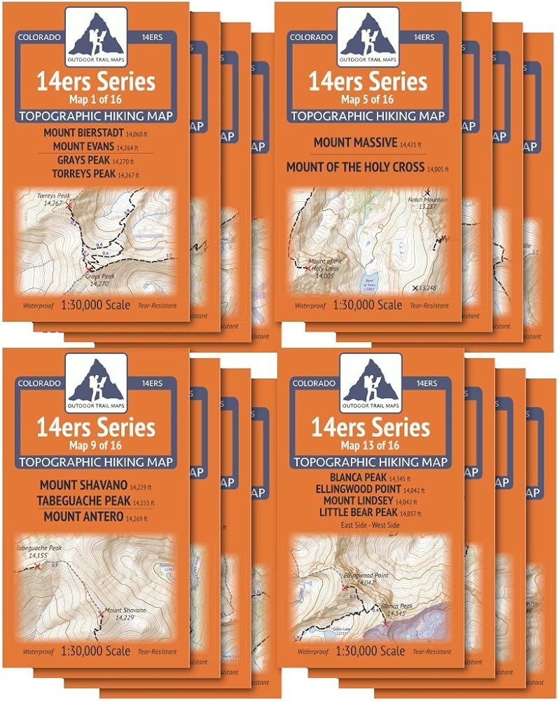
All sixteen maps of the Outdoor Trail Maps Colorado 14ers Map Series sold as a complete package covering all 58 of the Colorado fourteener (14,000 feet+ elevation) peaks. This map pack saves more than 25% off the retail price of these maps than if purchased separately. These rugged trail maps were designed for on-trail use in the toughest outdoor conditions in a compact and easy-to-fold size - no more fumbling with huge, inaccurate maps while on the go.
 Sangre de Cristo Wilderness NORTH - خريطة كولورادو الطبوغرافية للمشي لمسافات طويلة (2022)
KWD 4
Sangre de Cristo Wilderness NORTH - خريطة كولورادو الطبوغرافية للمشي لمسافات طويلة (2022)
KWD 4
 راوة وايلدرنيس - خريطة كولورادو الطبوغرافية للمشي لمسافات طويلة (2018)
KWD 4.500
راوة وايلدرنيس - خريطة كولورادو الطبوغرافية للمشي لمسافات طويلة (2018)
KWD 4.500
 Lizard Head - جبل سنيفيلز البرية - خريطة كولورادو الطبوغرافية للمشي لمسافات طويلة (2018)
KWD 4
Lizard Head - جبل سنيفيلز البرية - خريطة كولورادو الطبوغرافية للمشي لمسافات طويلة (2018)
KWD 4
 Outdoor Trail Maps LLC Eagles Nest Wilderness - خريطة كولورادو الطبوغرافية للمشي لمسافات طويلة (2018)
KWD 4
Outdoor Trail Maps LLC Eagles Nest Wilderness - خريطة كولورادو الطبوغرافية للمشي لمسافات طويلة (2018)
KWD 4