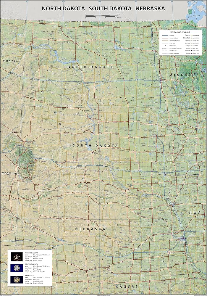
استكشف خريطتنا المادية التي تغطي داكوتاس - نورث داكوتا وداكوتا الجنوبية - ونيبراسكا ؛ مع معلومات حول العواصم والأحجام والسكان والمدن الرائدة ، بالإضافة إلى مواقع للمطارات والطرق السريعة والمناطق المكتظة بالسكان. يتميز داكوتاس ، الذي يضم عدد سكانه 1670324 نسمة ، بأعلى 39 من السكان في الولايات المتحدة ومرتبة الرابعة في تغطية المنطقة ، على ارتفاع 147،878 متر مربع (383،177 كيلومتر مربع).
موطن كل من السهول العليا والغرب الأوسط الأمريكي ، فإن داكوتاس لديها كثافة سكانية 9.8 لكل متر مربع (3.8 لكل كيلومتر مربع). ولاية نبراسكا هي ولاية أمريكية في الغرب الأوسط وتبلغ مساحة 77220 متر مربع (200000 كم 2) والسكان أكثر من 1.9 مليون. لينكولن هي العاصمة وأوماها ، على نهر ميسوري ، هي أكبر مدينة.
تتميز Dakotas و Nebraska بمناظر طبيعية جميلة ومجتمعات نابضة بالحياة. تعرف على المنطقة واكتسب تقديرًا أعمق لماضيها والحاضر مع هذه الخريطة المادية الشاملة.
 خريطة ملصق ولاية أوريغون - 23.3 × 16.5 بوصة - مغلفة بالورق
KWD 10.500
خريطة ملصق ولاية أوريغون - 23.3 × 16.5 بوصة - مغلفة بالورق
KWD 10.500
 -24%
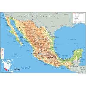
خريطة الملصقات المادية للمكسيك - 16.53 × 23.38 بوصة - ورق مغلف
KWD 8
-24%
خريطة الملصقات المادية للمكسيك - 16.53 × 23.38 بوصة - ورق مغلف
KWD 8
 -24%
خريطة الملصقات المادية لولاية ميسيسيبي - 14.4 × 25 بوصة - مغلفة بالورق
KWD 8
-24%
خريطة الملصقات المادية لولاية ميسيسيبي - 14.4 × 25 بوصة - مغلفة بالورق
KWD 8
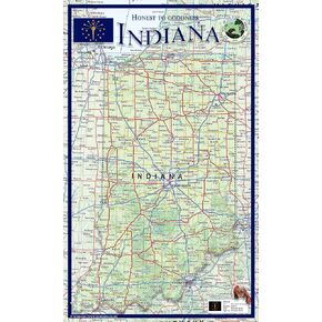 خريطة الملصقات المادية لولاية إنديانا - 14.2 × 23.3 بوصة - مغلفة بالورق
KWD 10.500
خريطة الملصقات المادية لولاية إنديانا - 14.2 × 23.3 بوصة - مغلفة بالورق
KWD 10.500