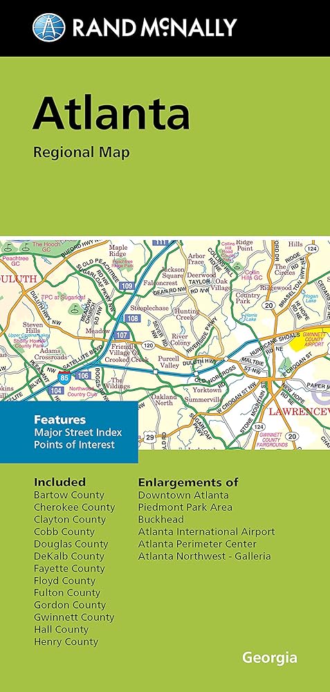
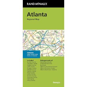
Clearly labeled Interstate, U.S., state, and county highways
Indications of parks, points of interest, airports, county boundaries, downtown & vicinity maps
Easy-to-use legend
Convenient folded size
Copyright 2022
Major Street Index
Points of Interest
Enlargements of Downtown Atlanta
Piedmont Park Area
Buckhorn
Atlanta International Airport
Atlanta Perimeter Center
Atlanta Northwest Galleria
وصف
Our trusted cartography shows all Interstate, U.S., state, and county highways, along with clearly indicated parks, points of interest, airports, county boundaries, and streets. The easy-to-use legend and detailed index make for quick and easy location of destinations. You'll see why Rand McNally folded maps have been the trusted standard for years.