- Shopping, made easy.
- /
- Get the app!
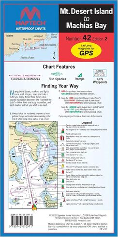
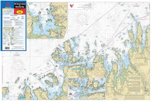
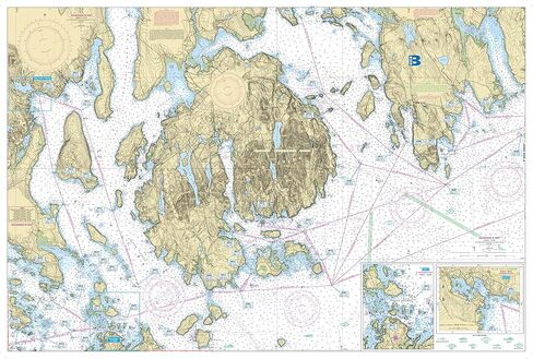
MAPTECH Waterproof Chart #42 2nd Edition Mt. Desert Island to Machias Bay. A great chart for navigating the Mt Desert Island Region of Maine. Detailed chart coverage from Mt. Desert island to Machias Bay. Features include: waypoints for major buoys, courses and distances, ramp locations, and fishing spots with fish species. 24" x 36", 12” x 6” folded , scale 1:57,140, with Insets for Blue Hill Harbor, Casco Passage, Jonesport, and Machiasport.