- التسوق ، اصبح سهلا.
- /
- احصل على التطبيق!
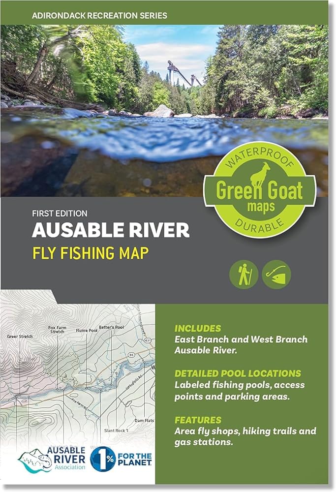
AUSABLE RIVER FLY FISHING MAP [ADIRONDACKS LAKE PLACID WILMINGTON WHITEFACE]
GREEN GOAT MAPS makes the most detailed and up to date hiking and trail maps for the outdoors. Our trail maps feature travel, hiking, fishing, and boating information. Our maps are designed for you to plan trips to locations and inspire your next adventure. We offer a variety of maps in various locations.
Our Ausable River Fly Fishing Map features the East Branch and West Branch of the Ausable River, river currents, access paths, parking areas, NYS fishing regulations, a hatch chart, local fly shops, and more. Labeled fishing pools and nearby hiking trails near the Adirondack High Peaks. Made with river users of every kind in mind, this map is ideal for anglers, paddlers, and all who enjoy exploring and recreating on the beautiful Ausable River.
All of our maps have an ecological focus. This map, in partnership with the Ausable River Association, highlights river health and native species. Green Goat Maps gives 1% back to nonprofits through 1% for the Planet.
SUPPORT NATURE: This map highlights responsible winter recreation and Leave No Trace principles through a partnership with the Barkeater Trail Alliance.
MADE IN THE USA: Cartography and design done in New York and printing done in Colorado.
MAP MEASURES:
Unfolded: 18x24"
Folded: 4x6"
Start planning your next adventure today!
 -33%
لوشن التسمير التدريجي من بوندي ساندز | تعمل عناصر التسمير ذات المستوى المنخفض على تطوير سمرة ذاتية ذات مظهر طبيعي لبشرة متوهجة يوميًا | 150 مل، 5.07 فلوريدا. أوز.
KWD 6
-33%
لوشن التسمير التدريجي من بوندي ساندز | تعمل عناصر التسمير ذات المستوى المنخفض على تطوير سمرة ذاتية ذات مظهر طبيعي لبشرة متوهجة يوميًا | 150 مل، 5.07 فلوريدا. أوز.
KWD 6
 رأس طائر إيربليتي، شماعات أوزان أذن الأفعى المتدلية لا تسبب الحساسية من الفولاذ المقاوم للصدأ 316L من أجل ثقب شحمة الأذن الممتدة وسدادات الأذن ومقاييس مجوهرات الجسم
KWD 8.500
رأس طائر إيربليتي، شماعات أوزان أذن الأفعى المتدلية لا تسبب الحساسية من الفولاذ المقاوم للصدأ 316L من أجل ثقب شحمة الأذن الممتدة وسدادات الأذن ومقاييس مجوهرات الجسم
KWD 8.500
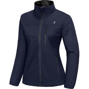 سترة نسائية خفيفة الوزن من Little Donkey Andy سترة واقية من الرياح للجري والسفر والمشي لمسافات طويلة، مقاومة للرياح، طاردة للماء
KWD 16.500
سترة نسائية خفيفة الوزن من Little Donkey Andy سترة واقية من الرياح للجري والسفر والمشي لمسافات طويلة، مقاومة للرياح، طاردة للماء
KWD 16.500
 -44%
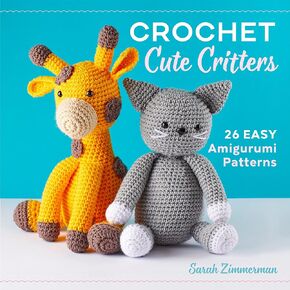
مخلوقات كروشيه لطيفة: 26 نمط أميجورومي سهل
KWD 4.500
-44%
مخلوقات كروشيه لطيفة: 26 نمط أميجورومي سهل
KWD 4.500