- التسوق ، اصبح سهلا.
- /
- احصل على التطبيق!
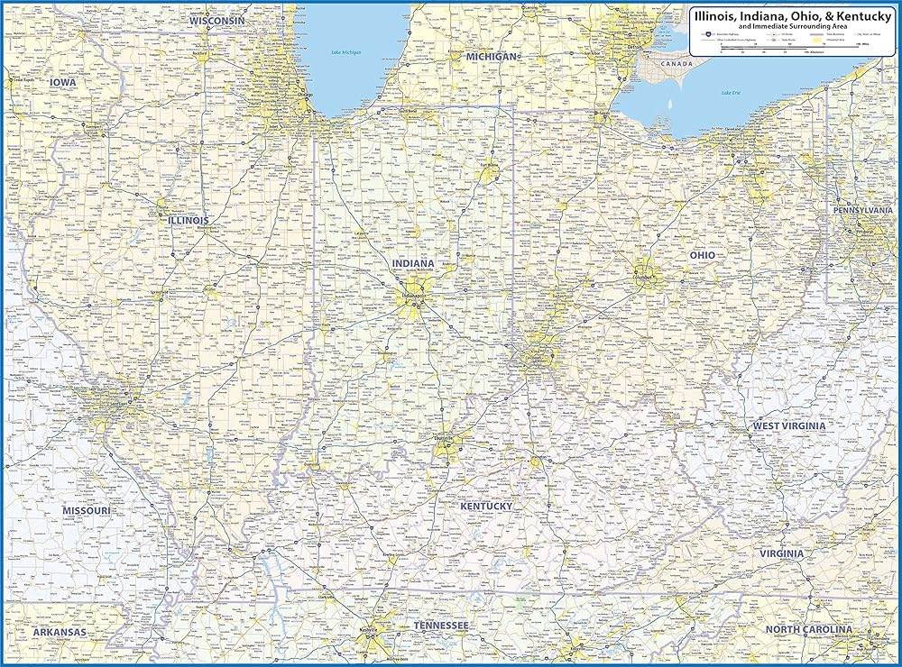
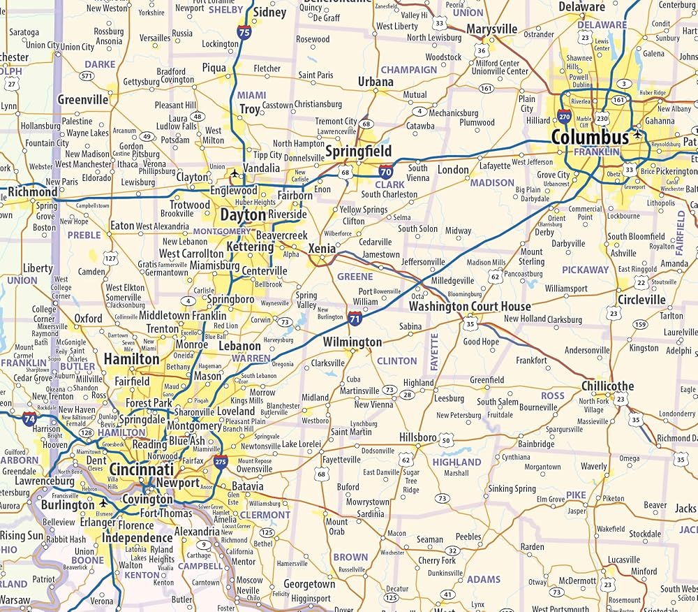
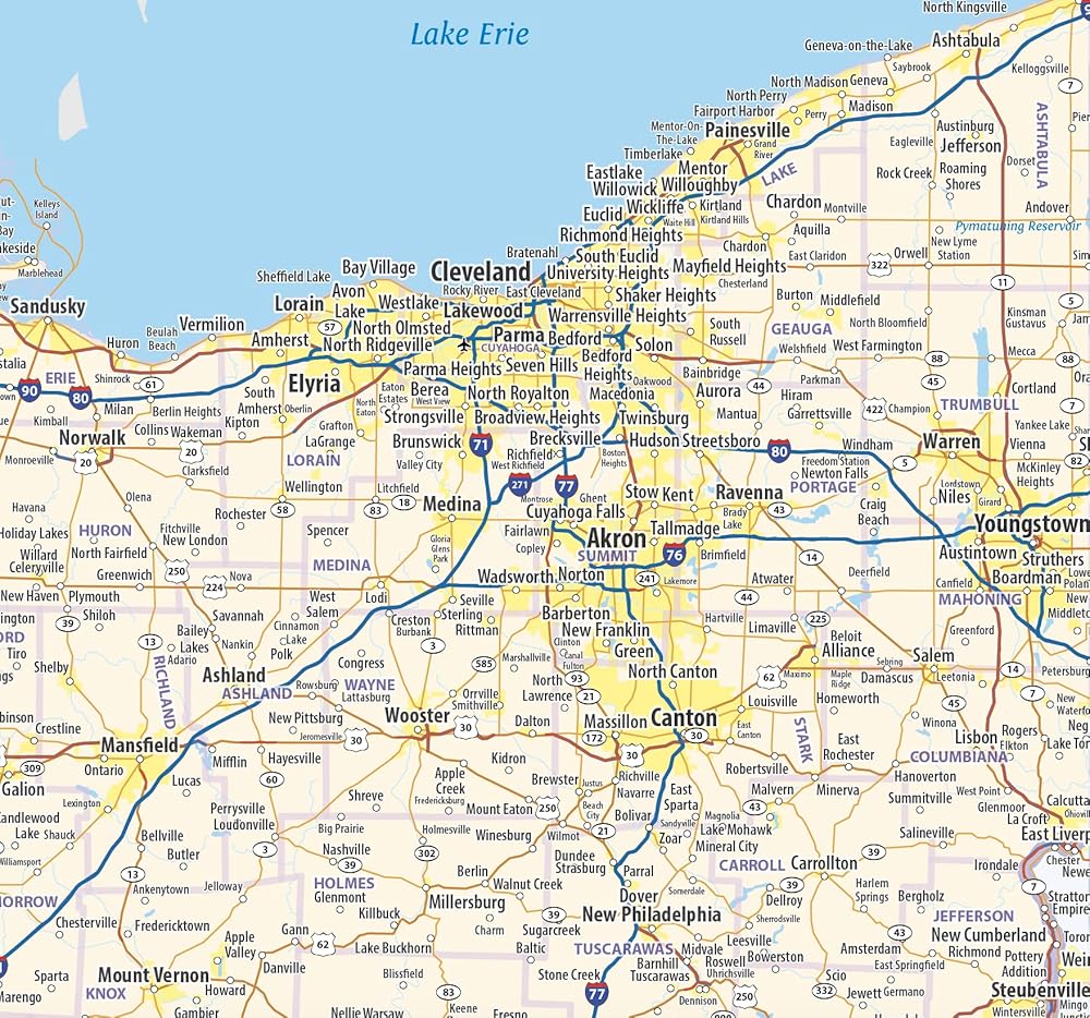
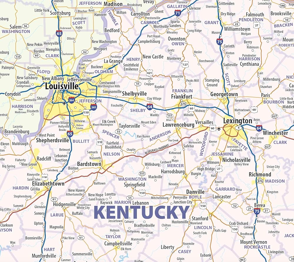
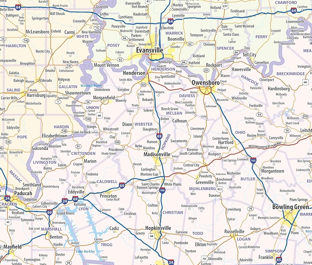
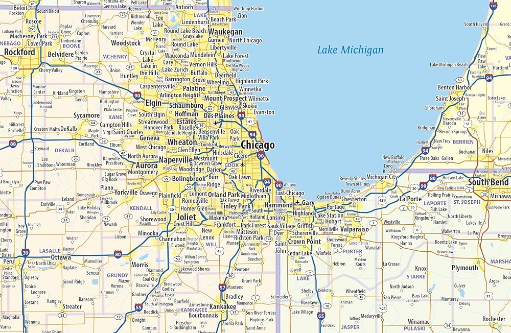
Our Illinois, Indiana, Ohio, & Kentucky Regional Wall Map displays this area of the central US as well as parts of adjacent states. The map shows cities, counties, interstates, and major highways. It is the perfect wall map to see the big picture of this vital part of the United States. The map is printed on heavyweight paper with a dry-erase lamination that allows the use of write-on/wipe-off dry-erase markers. It is rolled and shipped in a sturdy tube.
 -9%
إطار صورة شرف لجائزة موظف الشهر أو الربع أو العام. لوحة صورة مقاس 8x10 بوصة تحمل صورة مقاس 4x6 بوصة. جائزة تقدير الموظف
KWD 10
-9%
إطار صورة شرف لجائزة موظف الشهر أو الربع أو العام. لوحة صورة مقاس 8x10 بوصة تحمل صورة مقاس 4x6 بوصة. جائزة تقدير الموظف
KWD 10
 مكتبة بيت الشجرة السحرية 28 سلسلة مجموعة غلاف ورقي بيت الشجرة السحري 1-28 مجموعة كاملة مع صندوق مواد التعليم في مرحلة الطفولة المبكرة
KWD 22.500
مكتبة بيت الشجرة السحرية 28 سلسلة مجموعة غلاف ورقي بيت الشجرة السحري 1-28 مجموعة كاملة مع صندوق مواد التعليم في مرحلة الطفولة المبكرة
KWD 22.500
 ميدالية AA لمدة 18 شهرًا - شجرة الحياة الخضراء والزرقاء، مدمني الكحول المجهولين، شريحة الرصانة، رمز مميز، عملة
KWD 9
ميدالية AA لمدة 18 شهرًا - شجرة الحياة الخضراء والزرقاء، مدمني الكحول المجهولين، شريحة الرصانة، رمز مميز، عملة
KWD 9
 9 سنوات، زمالة المدمنين المجهولين، زمالة المدمنين المجهولين، العيش النظيف - رقاقة قوس قزح، ميدالية، رمز مميز
KWD 9.500
9 سنوات، زمالة المدمنين المجهولين، زمالة المدمنين المجهولين، العيش النظيف - رقاقة قوس قزح، ميدالية، رمز مميز
KWD 9.500