- التسوق ، اصبح سهلا.
- /
- احصل على التطبيق!

Laminated wall map of the Greater Portland Metro area showing locations within 20 miles of downtown Portland, including parts of Multnomah, Washington, Columbia, Clark, Clackamas, and Yamhill Counties. Communities included are Portland, Vancouver, Gresham, Beaverton, Aloha, Tigard, Hillsboro, Lake Oswego, Oregon City, Newberg, Canby, Saint Helens, and Forest Grove, among many others. Features shown include cities, towns, major roads and highways, zip codes, and major points of interest. An index of community names is included. The laminated map is rolled and shipped in a tube.
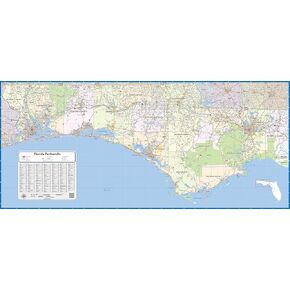 خريطة جدار مغلفة في فلوريدا (48 بوصة على ارتفاع 22 بوصة)
KWD 62.500
خريطة جدار مغلفة في فلوريدا (48 بوصة على ارتفاع 22 بوصة)
KWD 62.500
 2 PCS خزانة خلفية مغناطيسية الأزهار سلسة الحدود الأفقية مجردة الزهور الصفراء 12 "× 36" الجدار ملصق مغناطيسي ملحقات الخزانة القابلة للإزالة ديكور سهل التثبيت لمدرسة المكتب
KWD 12.500
2 PCS خزانة خلفية مغناطيسية الأزهار سلسة الحدود الأفقية مجردة الزهور الصفراء 12 "× 36" الجدار ملصق مغناطيسي ملحقات الخزانة القابلة للإزالة ديكور سهل التثبيت لمدرسة المكتب
KWD 12.500
 مجموعة هندسة نظرية فيثاغور
KWD 7.500
مجموعة هندسة نظرية فيثاغور
KWD 7.500
 Muir Way خريطة النهر الهيدرولوجية لألاباما - فن الجدار الطبوغرافي المائي للمنزل أو المكتب أو ديكور السفر - طباعة الورق المسطح غير المؤلف ، 24 × 30
KWD 32.500
Muir Way خريطة النهر الهيدرولوجية لألاباما - فن الجدار الطبوغرافي المائي للمنزل أو المكتب أو ديكور السفر - طباعة الورق المسطح غير المؤلف ، 24 × 30
KWD 32.500