- التسوق ، اصبح سهلا.
- /
- احصل على التطبيق!
Unique, full color, and detailed this political map of "United Kingdom and Ireland" features geographic detail and accuracy. The map shows all UK state country boundaries, place names, a selection National Parks, Airports, bodies of water, and more. Inset maps show the Shetland & Orkney Islands. Perfect for Schools, Home, Office or Home Schooling.
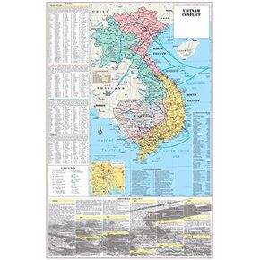 خرائط البومة الباردة فيتنام حرب الصراع الخريطة الملصق العسكري - 24 "x36" مغلفة
KWD 10.500
خرائط البومة الباردة فيتنام حرب الصراع الخريطة الملصق العسكري - 24 "x36" مغلفة
KWD 10.500
 خرائط البومة الباردة ملصق خريطة الحائط في ولاية كولورادو ملصق 32 "x24" (مغلفة)
KWD 10.500
خرائط البومة الباردة ملصق خريطة الحائط في ولاية كولورادو ملصق 32 "x24" (مغلفة)
KWD 10.500
 خرائط البومة الباردة ملصق خريطة الحائط في ولاية نيويورك مدفوعة 24 "WX30" H (مغلفة)
KWD 10.500
خرائط البومة الباردة ملصق خريطة الحائط في ولاية نيويورك مدفوعة 24 "WX30" H (مغلفة)
KWD 10.500
 خرائط البومة الباردة بنسلفانيا ملصق خريطة الحائط الحائط المليئة 34 "WX24" H (مغلفة)
KWD 10.500
خرائط البومة الباردة بنسلفانيا ملصق خريطة الحائط الحائط المليئة 34 "WX24" H (مغلفة)
KWD 10.500

