- Shopping, made easy.
- /
- Get the app!
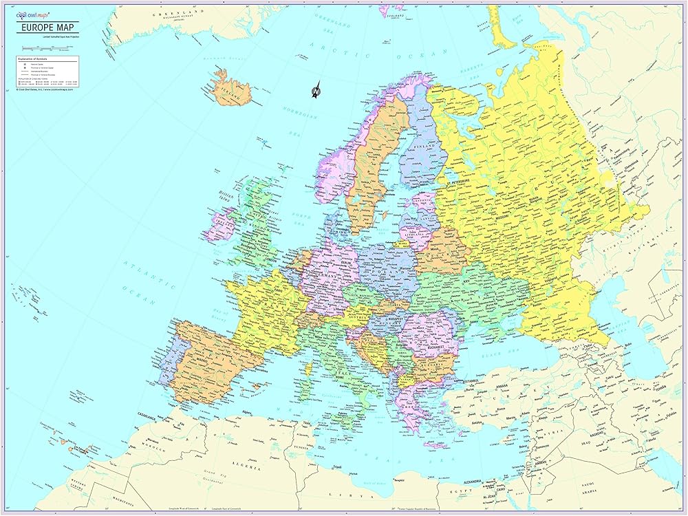
Unique, full color, and detailed this political map of Europe features geographic detail and accuracy. This map shows boundaries, place names, bodies of water, and more. All current country information. Perfect for Schools, Home, Office or Home Schooling. - Country color and banded boundaries - Country Capitals - Major cities - Major Geographical features - Size 32"W x 24"H inches or 40"x30".
 Ballet Dancer Incentive Stamp - DIY Crafts, Teacher Stamps for Grading - Cute Dance Themed Kids Stamp, Wooden/Rubber Peg Stamp for Students, Classroom, Homework, Grading and Crafts
KWD 2.500
Ballet Dancer Incentive Stamp - DIY Crafts, Teacher Stamps for Grading - Cute Dance Themed Kids Stamp, Wooden/Rubber Peg Stamp for Students, Classroom, Homework, Grading and Crafts
KWD 2.500
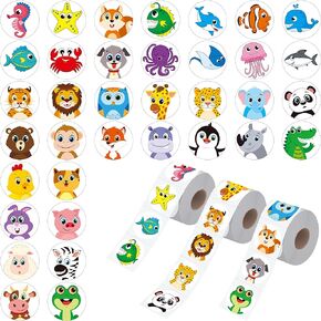 1800 PCS Round Animal Stickers, 36 Designs Wild/Farm/Marine Animal Cartoon Teacher Reward Stickers for Kids, Party Decoration Sticker for School Classroom Home with Perforation Line(1" Each, 3 Rolls)
KWD 4.500
1800 PCS Round Animal Stickers, 36 Designs Wild/Farm/Marine Animal Cartoon Teacher Reward Stickers for Kids, Party Decoration Sticker for School Classroom Home with Perforation Line(1" Each, 3 Rolls)
KWD 4.500
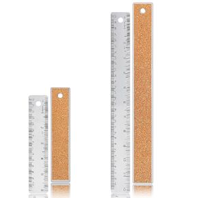 Metal Ruler 6 Inch 12 Inch Stainless Steel Metal Ruler with Cork Backing, Non-Slip Rulers with Inch and Centimeters, Straight Edge Cork Base Rulers for Student School Office Drafting Tools
KWD 2.500
Metal Ruler 6 Inch 12 Inch Stainless Steel Metal Ruler with Cork Backing, Non-Slip Rulers with Inch and Centimeters, Straight Edge Cork Base Rulers for Student School Office Drafting Tools
KWD 2.500
 -28%
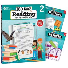
180 Days™: Includes Reading 2nd Edition, Writing, and Math for 2nd Grade Practice Workbook for Classroom and Home, Cool and Fun Practice Created by Teachers (180 Days of Practice)
KWD 19.500
-28%
180 Days™: Includes Reading 2nd Edition, Writing, and Math for 2nd Grade Practice Workbook for Classroom and Home, Cool and Fun Practice Created by Teachers (180 Days of Practice)
KWD 19.500