- Shopping, made easy.
- /
- Get the app!
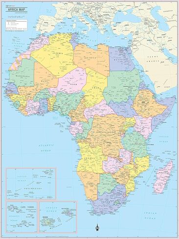
Unique, full color, and detailed this political map of Africa Continent features geographic detail and accuracy. The map shows boundaries, place names, bodies of water, and more. Inset maps show insets of Cape Verde, Reunion & Mauritius and Seychelles. All current 2021 country information. Perfect for Schools, Home, Office or Home Schooling. - Country color and banded boundaries - Country Capitals - Major cities - Major Geographical features - Size 32"W x 24"H inches - MADE/PRINTED in U.S.A. Paper 24"x32" and 30x40 paper versions available.
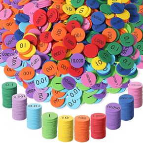 Kingdder Place Value Disks 10 Decimals to Whole Numbers Counting Chips for Kids Base 10 Place Value Manipulatives Math Counters Discs Set for Elementary School Math Supplies(3000 Pcs)
KWD 24
Kingdder Place Value Disks 10 Decimals to Whole Numbers Counting Chips for Kids Base 10 Place Value Manipulatives Math Counters Discs Set for Elementary School Math Supplies(3000 Pcs)
KWD 24
 -13%
Guided Reading Strips, 32 PCS Highlight Strips Colored Overlay Sentence Highlight Strip Reader Tracker Bookmark Dyslexia Reading Tools Strip for Student Children Teacher Supply Assistant
KWD 3.500
-13%
Guided Reading Strips, 32 PCS Highlight Strips Colored Overlay Sentence Highlight Strip Reader Tracker Bookmark Dyslexia Reading Tools Strip for Student Children Teacher Supply Assistant
KWD 3.500
 -50%
2 Pack 12 inch Clear Plastic Ruler, 30 cm Straight Rulers, Transparent Measuring Tools, Drafting Tools, Flexible Ruler with Inches and Centimeters for School and Office Supply
KWD 1.500
-50%
2 Pack 12 inch Clear Plastic Ruler, 30 cm Straight Rulers, Transparent Measuring Tools, Drafting Tools, Flexible Ruler with Inches and Centimeters for School and Office Supply
KWD 1.500
 -24%
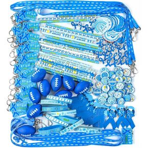
360 Pcs Child Abuse Prevention Awareness Supplies Blue Ribbon Awareness Kit Include Bracelet Keychain Rugby Pencil Pin Cutouts Lanyard Stickers for Child Abuse Prevention Month Fundraising Gift Giving
KWD 20.500
-24%
360 Pcs Child Abuse Prevention Awareness Supplies Blue Ribbon Awareness Kit Include Bracelet Keychain Rugby Pencil Pin Cutouts Lanyard Stickers for Child Abuse Prevention Month Fundraising Gift Giving
KWD 20.500
