- Shopping, made easy.
- /
- Get the app!

Unique, color banded, this political LARGE PRINT map of Tennessee state features geographic detail and accuracy. The map shows all county boundaries, county names with their capitals. Perfect for Schools, Home, Office or Home Schooling. - Large Print for easy reading - Counties with banded boundaries - All counties and their capitals - Selection of cities, parks, monuments, major Roads, and major Geographical features
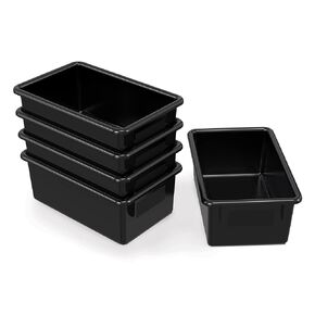 Jonti-Craft 8020JC5 Cubbie-Tray, Black, Pack of 5
KWD 20.500
Jonti-Craft 8020JC5 Cubbie-Tray, Black, Pack of 5
KWD 20.500
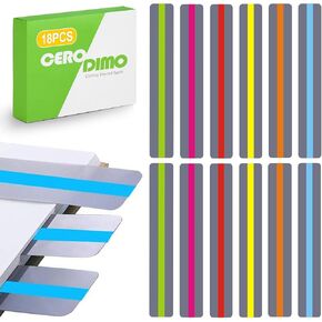 18 Pcs Guided Reading Strips, Dyslexia Tools, Reading Trackers, Highlight Strips and Bookmarks, Reading Guide, Assorted Colors Help with Dyslexia for Children and Teacher Supply Assistant
KWD 2.500
18 Pcs Guided Reading Strips, Dyslexia Tools, Reading Trackers, Highlight Strips and Bookmarks, Reading Guide, Assorted Colors Help with Dyslexia for Children and Teacher Supply Assistant
KWD 2.500
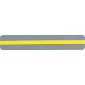 Ashley Reading Guide Strips, Yellow, 7" x 1.3"
KWD 5.500
Ashley Reading Guide Strips, Yellow, 7" x 1.3"
KWD 5.500
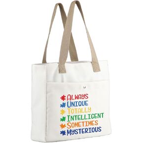 MBMSO Autism Tote Bag Autism Awareness Gifts for Autism Mom Bag Special Education Gifts for Autism Teacher Appreciation Gifts
KWD 6.500
MBMSO Autism Tote Bag Autism Awareness Gifts for Autism Mom Bag Special Education Gifts for Autism Teacher Appreciation Gifts
KWD 6.500
