- Shopping, made easy.
- /
- Get the app!
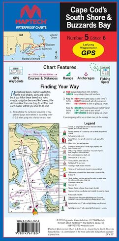
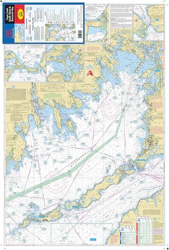
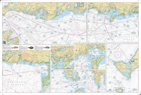
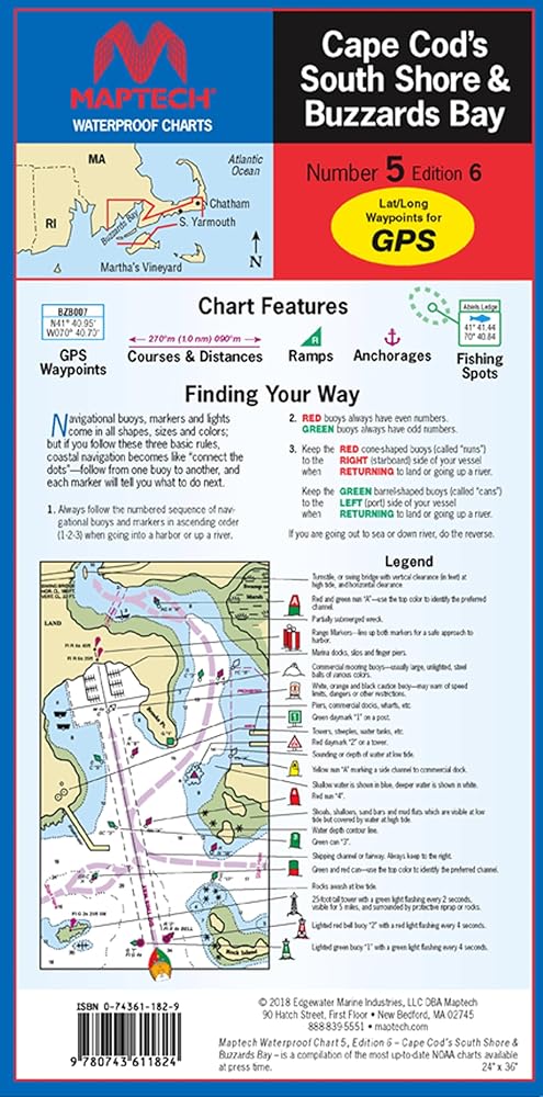
The MAPTECH Waterproof Chart WPC005-06, Cape Cod's South Shore & Buzzards Bay is an indispensable tool for navigating the waters around Cape Cod. This 6th edition chart provides highly detailed coverage of Buzzards Bay, Vineyard Sound, and the South Shore of Cape Cod, making it a must-have for boaters and sailors exploring the region. The user-friendly, flip-fold format measures 24 inches x 36 inches when open and a compact 6 inches x 12 inches when folded, making it easy to store and reference on board. With scales of 1:53,333 and 1:57,140, and insets for added detail, this chart offers precise and comprehensive information. It features GPS waypoints for major buoys, courses and distances, wreck sites, and ramp locations and information, ensuring safe and efficient navigation. Printed on high-quality, waterproof synthetic paper, this chart is designed to withstand the elements, ensuring its longevity and reliability on the water. Whether you're an experienced mariner or a recreational boater, the MAPTECH Waterproof Chart Cape Cod's South Shore & Buzzards Bay is an essential tool for exploring the stunning coastal waters of Massachusetts.
 Sangre de Cristo Wilderness NORTH - Colorado Topographic Hiking Map (2022)
KWD 4
Sangre de Cristo Wilderness NORTH - Colorado Topographic Hiking Map (2022)
KWD 4
 YellowMaps Clanton East AL topo map, 1:24000 Scale, 7.5 X 7.5 Minute, Historical, 1972, Updated 1984, 26.7 x 21.9 in
KWD 12.500
YellowMaps Clanton East AL topo map, 1:24000 Scale, 7.5 X 7.5 Minute, Historical, 1972, Updated 1984, 26.7 x 21.9 in
KWD 12.500
 Rawah Wilderness - Colorado Topographic Hiking Map (2018)
KWD 4
Rawah Wilderness - Colorado Topographic Hiking Map (2018)
KWD 4
 Boulder County Recreation Topographic Map
KWD 8.500
Boulder County Recreation Topographic Map
KWD 8.500