SHADED RELIEF: Bring the world around you to life, with 3D rendered land and underwater elevation – including areas of Ultra-High-Res Bathymetric imagery – a game-changer for anglers and divers
FULL-FEATURED VECTOR CHARTS: Making navigation easy by giving you accurate, up-to-date vector chart detail derived from official Hydrographic Office information
HIGH-RES BATHY: Helps you identify shallow areas, drop-offs, ledges, holes or humps. Now includes compiled and quality-controlled Genesis detail as part of singular HRB layer
CUSTOM DEPTH SHADING: Set a clear safety depth, maintain a paper-like view or create your own custom shading
EASY ROUTING: Helps you automatically plot the shortest, safest route based on detailed chart data and your personalized vessel information. No subscription required
INSTALLATION: This product comes programmed on a Micro-SD fitted in a SD card, most chart plotters come with a Micro SD card reader. To use this chart the Micro-SD card needs to be ejected from the SD adapter
COMPATIBILITY: This REVEAL product is only compatible with the following models: HDS PRO, HDS LIVE, HDS CARBON, Elite-FS, Elite-Ti2, Elite-Ti, NSSevo3s, NSSevo3, NSSevo2, NSOevo3s, NSOevo3, NSOevo2, Go


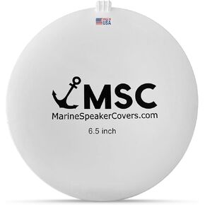 6.5" Marine Speaker Cover Boat Speaker Protector with Sun, Water, Dust, UV Protection, Military-Grade Silicone Design, White Case with Black Logo, Sold as Pair (167mm)
KWD 18.500
6.5" Marine Speaker Cover Boat Speaker Protector with Sun, Water, Dust, UV Protection, Military-Grade Silicone Design, White Case with Black Logo, Sold as Pair (167mm)
KWD 18.500
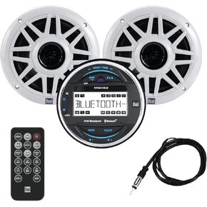 Dual Electronics MXPGH52 Marine Radio | Gauge Hole Media Receiver with Bluetooth | (2) 6.5" Marine Stereo Boat Speakers | Wireless Remote Control and Antenna Combo Pack
KWD 59
Dual Electronics MXPGH52 Marine Radio | Gauge Hole Media Receiver with Bluetooth | (2) 6.5" Marine Stereo Boat Speakers | Wireless Remote Control and Antenna Combo Pack
KWD 59
 C-MAP® Discover™ X - North America
KWD 59
C-MAP® Discover™ X - North America
KWD 59
 C-MAP® Reveal™ X - US Lakes - North East
KWD 61.500
C-MAP® Reveal™ X - US Lakes - North East
KWD 61.500
