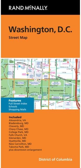
Clearly labeled Interstate, U.S., state, and county highways
Indications of parks, points of interest, airports, county boundaries, and more
Detailed and full street index
Coverage Area: Alexandria, Va Bladensburg, Md Cheverly, Md Chevy Chase, Md College Park, Md Falls Church, Va Glenarden, Md Hyattsville, Md New Carrollton, Md Takoma Park, Md plus downtown enlargement.
Description
Rand McNally's folded map for Washington, D.C. is a must-have for anyone traveling in and around this part of District of Columbia, offering unbeatable accuracy and reliability at a great price. Our trusted cartography shows all Interstate, U.S., state, and county highways, along with clearly indicated parks, points of interest, airports, county boundaries, and streets. The easy-to-use legend and detailed index make for quick and easy location of destinations. You'll see why Rand McNally folded maps have been the trusted standard for years.