- التسوق ، اصبح سهلا.
- /
- احصل على التطبيق!
Saco Bay, ME 13287. This Framed Nautical Map covers the area of shoreline of the beautiful coast of Saco Bay, Maine. The Framed Nautical Chart is the official NOAA Nautical Chart detailing the waterways of Saco Bay; including Biddeford, Biddeford Pool, Old Orchard Beach Scarborough Beach, Prouts Neck, and other harbors and towns. Product Details: NOAA Nautical Chart 13287. Standard Frame is 24" W. x 20" H. Poster frame is 36" W. x 30" H. Solid Hardwood Frame, Glasss front, Black Matte, Duster Backing with Wire Hanging, Handmade in USA.


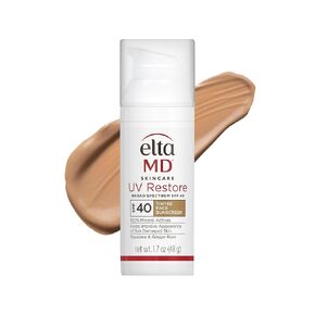 EltaMD UV Restore Tinted Face Sunscreen، عامل حماية من الشمس SPF 40 ملون معدني لإصلاح البشرة المتضررة من الشمس، ويحسن ليونة البشرة والاحتفاظ بالرطوبة، يوصي به أطباء الجلدية، أنبوب 2 أونصة
KWD 20
EltaMD UV Restore Tinted Face Sunscreen، عامل حماية من الشمس SPF 40 ملون معدني لإصلاح البشرة المتضررة من الشمس، ويحسن ليونة البشرة والاحتفاظ بالرطوبة، يوصي به أطباء الجلدية، أنبوب 2 أونصة
KWD 20
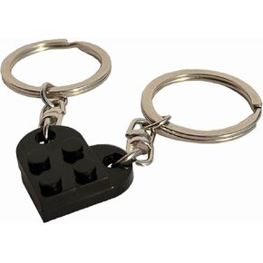 سلسلة مفاتيح من الطوب أفضل صديق سلسلة مفاتيح للصداقة والزوجين والصديقات والصديقات، مجموعة سلسلة مفاتيح على شكل قلب لعيد الحب وسلسلة مفاتيح لعيد الميلاد للزوج والزوجة هدية سلسلة مفاتيح له
KWD 2.500
سلسلة مفاتيح من الطوب أفضل صديق سلسلة مفاتيح للصداقة والزوجين والصديقات والصديقات، مجموعة سلسلة مفاتيح على شكل قلب لعيد الحب وسلسلة مفاتيح لعيد الميلاد للزوج والزوجة هدية سلسلة مفاتيح له
KWD 2.500
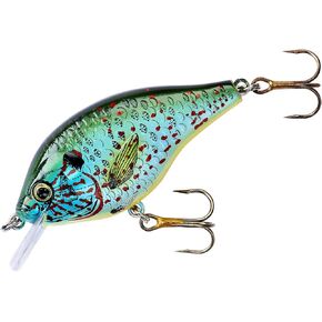 طُعم الصيد المربع بلوجيل من ريبل ليور مع خطاطيف لا حلوى، 6.35 سم، 1.13 جم
KWD 5.500
طُعم الصيد المربع بلوجيل من ريبل ليور مع خطاطيف لا حلوى، 6.35 سم، 1.13 جم
KWD 5.500
 دورة البيانو الممتازة في عيد الميلاد، الطابق الرابع (دورة البيانو الممتازة، الطابق الرابع)
KWD 4
دورة البيانو الممتازة في عيد الميلاد، الطابق الرابع (دورة البيانو الممتازة، الطابق الرابع)
KWD 4


