- التسوق ، اصبح سهلا.
- /
- احصل على التطبيق!
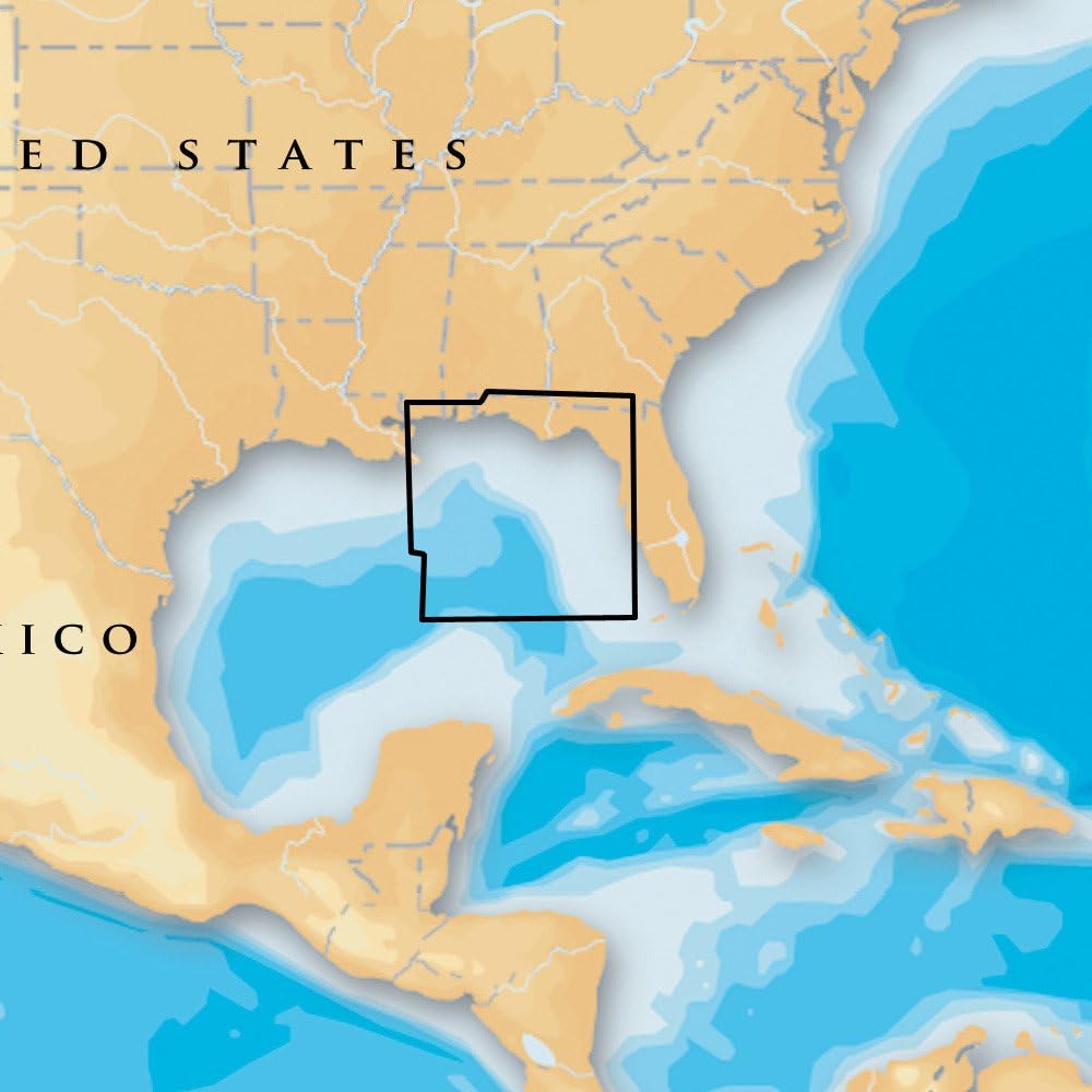
Navionics Marine Cartography Navionics Platinum+ Compatible With Chart Plotters Detailed Coverage Of US South - Lakes, Rivers And Coastal; Region Code: NPUS006R; On SD/Micro-SD Card; One-Year Subscription; With Auto Guidance Technology, High-Resolution Relief Shading, High-Resolution Satellite Imagery, Aerial Photography, 3D View Nautical Chart: Comprehensive Charts Are Derived From Multiple Official, Government And Private Sources, Displayed In A Familiar Look And Feel Community Edits: Get Useful Local Knowledge From Edits Made By Users Of The Navionics Boating App On Your Compatible Smart Device Dock-To-Dock Route Guidance: Start Your Trip With A Suggested Path SonarChart Live Mapping Feature: Watch New HD Depth Maps Develop In Real Time As Your Boat Moves Through The Water 3D View: Adjust The Perspective Of Your Chart View To Highlight Key Features And Enhance Awareness Aerial Photos: Get A Better Sense Of Your Surroundings
 مجموعة بوابة تحديد المواقع من موتور جايد
KWD 62.500
مجموعة بوابة تحديد المواقع من موتور جايد
KWD 62.500
 علبة تاكو اوتريجر لاين
KWD 21
علبة تاكو اوتريجر لاين
KWD 21
 طقم صامولة دعامة من مين كوتا 1865010، 3/8 بوصة (أ)
KWD 6
طقم صامولة دعامة من مين كوتا 1865010، 3/8 بوصة (أ)
KWD 6
 شكسبير 4186U نايلون بسقاطة - غير مجمعة
KWD 10.500
شكسبير 4186U نايلون بسقاطة - غير مجمعة
KWD 10.500