- التسوق ، اصبح سهلا.
- /
- احصل على التطبيق!
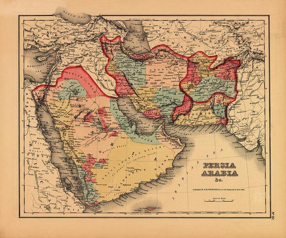
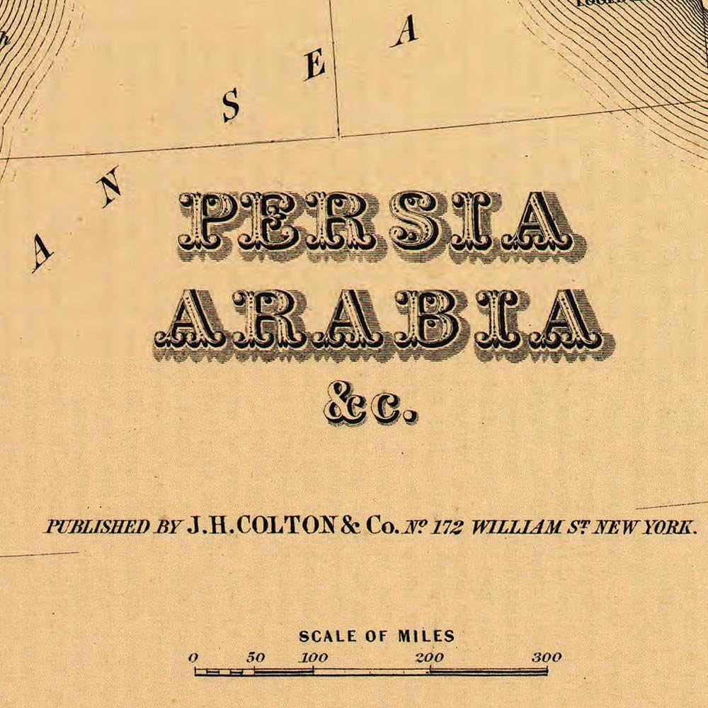
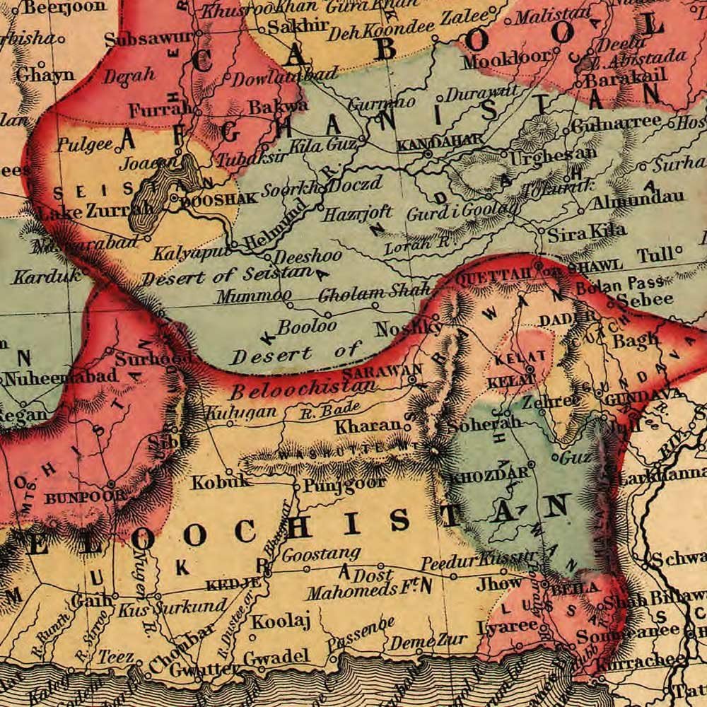
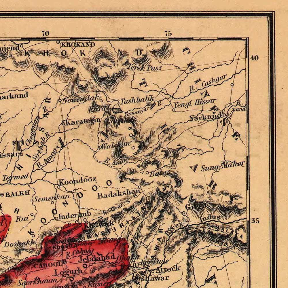
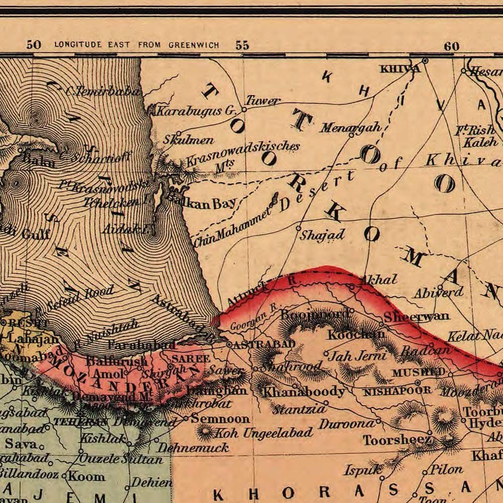
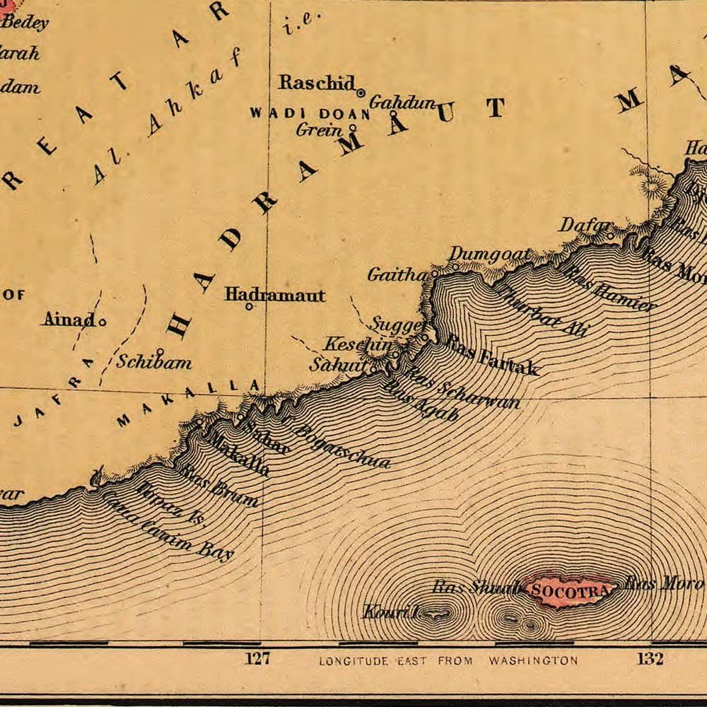
Middle East Including Persia and Arabia circa 1855
Crafted in 1855 by J.H. Colton and Company, this map provides a detailed depiction of the Middle East and Persia, featuring the Arabian Peninsula, Persia (present-day Iran), Afghanistan, and Baluchistan (modern-day Iran and Pakistan). Employing color to highlight borders, provinces, and settled areas, the map includes cities, mountains, roads, and topographical notes, showcasing a comprehensive understanding of the region's geography in mid-19th-century America. Adorned with decorative borders, the map, featured in Colton's General Atlas editions, combines precision and artistry, offering insight into the era's geographic knowledge and cultural aesthetics.
By combining high-quality satin paper with a giclee printing process, we offer this Middle East map with the most desirable characteristics - accurate colors, archival properties as well as both tear and water resistance. The image has been digitally captured directly from the original and displays a genuine look and tone; including small creases, flaws and aging. This adds to the authenticity, presentation and beauty of the piece. Our process produces this high-quality, low-cost Middle East art print for your home, office or living space, and it is sized to fit into economical standard frame formats (frames sold separately).
* Expertly sized to fit into economical and easy-to-find standard frames.
* Digitally refined and giclee printed in the United States with OEM ink sets.
* Produced on high-end, water-resistant and tear-proof satin polypropylene paper.
* Items are as pictured. Order with confidence. Satisfaction Guaranteed.
* Handled with care and shipped promptly in a heavy-gauge mailing tube.
 خرائط Antiguos الحدود المحيطة بلجوبستون ومتنزه غراند تيتون الوطني حوالي 1929 | ملصق طباعة الفن عتيقة ديكور الجدار | 18 × 24 بوصة (457 × 610 مم)
KWD 9.500
خرائط Antiguos الحدود المحيطة بلجوبستون ومتنزه غراند تيتون الوطني حوالي 1929 | ملصق طباعة الفن عتيقة ديكور الجدار | 18 × 24 بوصة (457 × 610 مم)
KWD 9.500
 خريطة أسماك كبيرة في أمريكا الشمالية ، دليل صيد مياه طازجة وملحية ، طباعة فن الجدار الزخرفي (24 × 24 بوصة)
KWD 7.500
خريطة أسماك كبيرة في أمريكا الشمالية ، دليل صيد مياه طازجة وملحية ، طباعة فن الجدار الزخرفي (24 × 24 بوصة)
KWD 7.500
 خرائط Antiguos تصوير كبير لفورت واين إنديانا في عام 1812 حوالي عام 1930 | ملصق طباعة الفن عتيقة ديكور جدار | 24 × 36 بوصة (610 × 915 مم)
KWD 11.500
خرائط Antiguos تصوير كبير لفورت واين إنديانا في عام 1812 حوالي عام 1930 | ملصق طباعة الفن عتيقة ديكور جدار | 24 × 36 بوصة (610 × 915 مم)
KWD 11.500
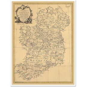 خريطة antiguos الخريطة التاريخية لأيرلندا الموضحة بالأسماء الأيرلندية والألقاب وحدود المقاطعات والمقاطعات | ملصق طباعة الفن عتيقة ديكور جدار | 18 × 24 بوصة
KWD 9.500
خريطة antiguos الخريطة التاريخية لأيرلندا الموضحة بالأسماء الأيرلندية والألقاب وحدود المقاطعات والمقاطعات | ملصق طباعة الفن عتيقة ديكور جدار | 18 × 24 بوصة
KWD 9.500