- التسوق ، اصبح سهلا.
- /
- احصل على التطبيق!
Bring geography to life with the US & World Advanced Political Classroom Map Pack by BrightWay Educational. Designed for grades 9+, this detailed two-map set features shaded relief and vivid color to highlight countries, territories, and key physical features. Ideal for classrooms, it offers the clarity and detail needed to support advanced geographic learning. These maps were designed with teachers and built for students. This advanced map set includes georeferencing & degree lines, national capitals, major and secondary cities, ocean currents, and bathymetric relief. Perfect for high school and college classrooms, these maps offer a deeper level of geographic detail. Regular updates ensure they're among the most current educational maps available. Product Features: Bright, vivid colors clearly define countries and territories, making the maps visually engaging for students grades 9+. Grades 9+ Focused: Designed specifically for high school and collegiate classrooms, these maps support advanced geography instruction. Shaded relief provides a detailed visualization of terrain, helping students better grasp the physical landscape of different regions. Georeference and degree lines offer spatial context, allowing students to comprehend the global grid system and improve map-reading skills. National capitals, major cities, secondary cities, and disputed areas are clearly labeled, offering one of the most information-rich political geography references available for classroom use. Comprehensive physical geography: Includes oceans, mountain ranges, islands, rivers, lakes, and marine features (plus ocean surface currents and bathymetric relief) to support a deeper understanding of both land and water geography. Map Details: World Map (Eckert IV Projection): An equal-area projection that accurately portrays landmass sizes with minimal distortion. Features detailed insets of Europe, Antarctica, and the Arctic, as well as an inset showing all continents and oceans, providing an even broader view of global geography. United States Map (Albers Equal Area): Depicts the U.S. with accurate proportions for all landmasses, ensuring geographical accuracy. Pick Your Choice of Additional Map Features: Flags: Choose the flags variation to include flags of the countries or states pictured on the map for added educational value. Educational Panels: Choose the Educational Panels option to include the following panels: o Population Density: Darker colors represent denser population areas, with major cities clearly highlighted. o Elevation & Terrain: An elevation ramp showcases the range of high and low elevations, with major physical features depicted in shaded relief and a side-on elevation profile for additional context. o Climate Zones: Displays Köppen climate classifications to help students understand global climate patterns and how they relate to geography, ecosystems, and human settlement. Ideal for classrooms, homeschool settings, and learning spaces, the US & World Advanced Political Classroom Map Pack by BrightWay Educational helps students in grades 9+ explore the world in depth. With enhanced details like shaded relief, disputed borders, ocean features, and major landforms, this set encourages critical thinking, geographic literacy, and global awareness. Designed to spark curiosity and support advanced geography instruction, it's a powerful tool for students ready to go beyond the basics.
 خريطة أمريكا الجميلة للخدش - خريطة سفر تفاعلية - ملصق للخدش يكشف عن تصوير طبيعي جميل لكل 50 ولاية - هدية للمسافرين - ديكور حائط للمسافر
KWD 13.500
خريطة أمريكا الجميلة للخدش - خريطة سفر تفاعلية - ملصق للخدش يكشف عن تصوير طبيعي جميل لكل 50 ولاية - هدية للمسافرين - ديكور حائط للمسافر
KWD 13.500
 -20%
أنشأ المعلم بطاقات ممارسة سياق الموارد
KWD 2
-20%
أنشأ المعلم بطاقات ممارسة سياق الموارد
KWD 2
 -14%
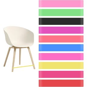
10pcs نطاقات كرسي ملونة ، فرقة تململ فرقة مطاطية ، مكاتب مرنة ، أدوات التوحد
KWD 3
-14%
10pcs نطاقات كرسي ملونة ، فرقة تململ فرقة مطاطية ، مكاتب مرنة ، أدوات التوحد
KWD 3
 -33%
مخطط مكافأة 23 Central 23 للأطفال الصغار × 10 أجهزة كمبيوتر - الأولاد الروتينيين في وقت النوم - تصميم البناء - مخططات مكافآت النوم للأطفال للنوم في السرير - تعقب السلوك مع الملصقات
KWD 3
-33%
مخطط مكافأة 23 Central 23 للأطفال الصغار × 10 أجهزة كمبيوتر - الأولاد الروتينيين في وقت النوم - تصميم البناء - مخططات مكافآت النوم للأطفال للنوم في السرير - تعقب السلوك مع الملصقات
KWD 3


