- التسوق ، اصبح سهلا.
- /
- احصل على التطبيق!
Explore the diverse terrain of this heartland region with the 1920 3D Raised Relief Map, showcasing its lakefront shores, rolling plains, and winding river valleys. This stunning original creation is transformed from a flat historical map, allowing you to visually and tactically explore the diverse terrain. Our 3D Raised Relief Maps are individually crafted through a meticulous process. The unique style of the raised relief lets you experience the map through touch and feel. These maps are designed to exceed expectations and last a lifetime. At Muir Way, we use scans of historical maps and georeference them with modern elevation data to align the raised terrain with the map. We then cut a detailed mold, followed by a process of printing, heating, and vacuum-forming onto the mold. Finally, we cut and mount it onto matboard for a stunning rigid raised relief map. You will love this map if you appreciate its unique characteristics. When the plastic is heated and stretched over the 3D mold, the image may be altered, causing slight distortions in lines and text around higher elevations. The fine print on plastic is not as sharp as on paper, sometimes rendering very small text less legible. Here at Muir Way, we design maps meant for walls—not just as art, but as reminders of the places we love most. Each map tells the story of a location, capturing its essence. We are committed to providing the utmost quality, design, and value in every piece we create.
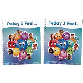 الأشياء الجيدة حقًا ، فاقد المشاعر ، كتاب محو جاف -مجموعة من الأطفال 2 -تساعد الأطفال على تحديد أنشطة المشاعر وتعلمها وإدارتها للتعبير عن المشاعر
KWD 22
الأشياء الجيدة حقًا ، فاقد المشاعر ، كتاب محو جاف -مجموعة من الأطفال 2 -تساعد الأطفال على تحديد أنشطة المشاعر وتعلمها وإدارتها للتعبير عن المشاعر
KWD 22
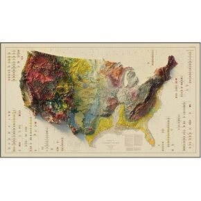 Muir Way - USA Geological 1932 خريطة الإغاثة المظللة - طباعة ورق ثنائية الأبعاد شقة - مظللة 3D الوهم - جودة ورق الفنون الجميلة والأحبار - 100 ٪ خالية من القطن - مصنوعة في الولايات المتحدة الأمريكية -42 "× 24" طباعة ثنائية الأبعاد - إطار لا.
KWD 36.500
Muir Way - USA Geological 1932 خريطة الإغاثة المظللة - طباعة ورق ثنائية الأبعاد شقة - مظللة 3D الوهم - جودة ورق الفنون الجميلة والأحبار - 100 ٪ خالية من القطن - مصنوعة في الولايات المتحدة الأمريكية -42 "× 24" طباعة ثنائية الأبعاد - إطار لا.
KWD 36.500
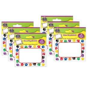 أنشأ المعلم الموارد المطبوعات الملونة المطبوعة علامات الأسماء ، 36 لكل حزمة ، 6 عبوات
KWD 10.500
أنشأ المعلم الموارد المطبوعات الملونة المطبوعة علامات الأسماء ، 36 لكل حزمة ، 6 عبوات
KWD 10.500
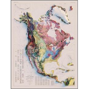 Muir Way - North America 1965 خريطة الإغاثة المظللة - طباعة الورق ثنائية الأبعاد شقة - وهم ثلاثي الأبعاد مظللة - جودة ورق الفنون الجميلة والأحبار - 100 ٪ من القطن وخالي من الأحماض - مصنوعة في الولايات المتحدة الأمريكية -24 "× 32" طباعة ثنائية الأبعاد - لا
KWD 43.500
Muir Way - North America 1965 خريطة الإغاثة المظللة - طباعة الورق ثنائية الأبعاد شقة - وهم ثلاثي الأبعاد مظللة - جودة ورق الفنون الجميلة والأحبار - 100 ٪ من القطن وخالي من الأحماض - مصنوعة في الولايات المتحدة الأمريكية -24 "× 32" طباعة ثنائية الأبعاد - لا
KWD 43.500


